
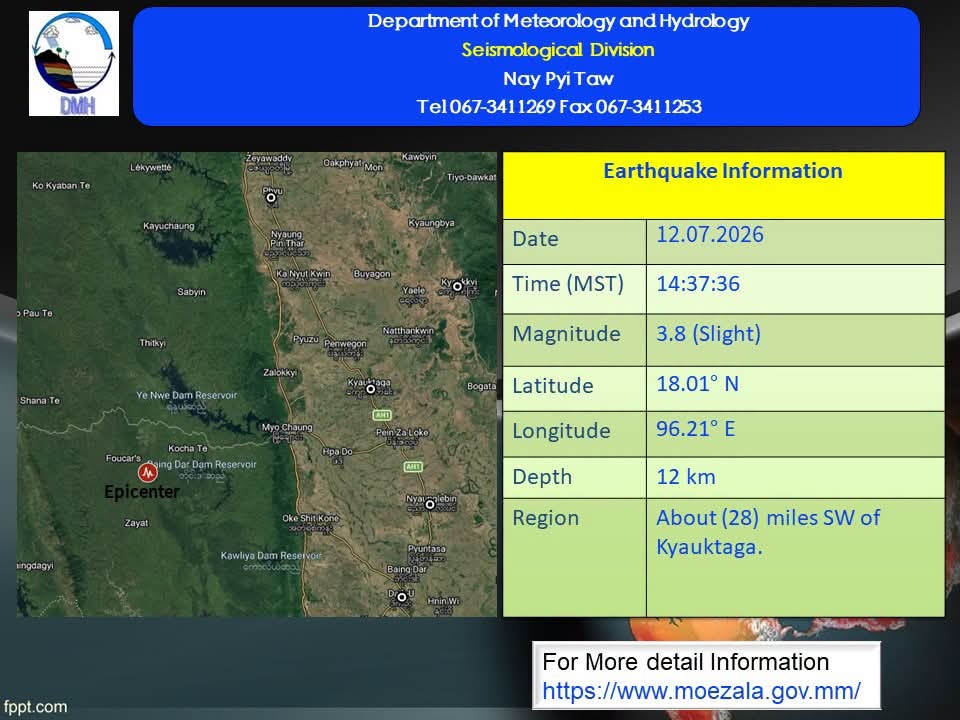
A minor earthquake measuring 3.8 on the Richter scale struck Myanmar at 2:37:36 pm yesterday, according to a statement released by the Department of Meteorology and Hydrology (DMH).
The earthquake was detected at a depth of 12 kilometres underground, with its epicentre located approximately 50 miles north-northwest of the Bago Seismic Station, about 28 miles southwest of Kyauktaga, 17 miles northwest of Nyaunglebin, and eight miles southwest of Penwegon.
Similarly, a minor earthquake measuring 4.0 magnitude struck at 05:09:23 am yesterday. According to the DMH, the earthquake occurred at a depth of 11 kilometres underground, with its epicentre located approximately 49 miles north-northwest of the Mandalay Seismic Station and about 11 miles north of Singu. The DMH had also previously reported that a 4.1-magnitude earthquake struck Singu Township in Mandalay Region on the morning of 17 June.
According to current seismic data for Myanmar, the country is expected to continue experiencing only routine, localized earthquakes ranging from magnitude 2.5 to 4.0, with no unusual changes detected, the AI Info Team reported. Furthermore, based on currently available geological data, there is no evidence to suggest that a major earthquake of magnitude 7.0 or higher will occur in the near future.
“However, earthquakes do not strike randomly. They are simply the natural, periodic release of stress accumulated over many years along tectonic plate boundaries. Only by staying vigilant and remaining prepared in advance can we mitigate the risks posed by earthquakes,” an official from the AI Info Team cautioned. — Htun Htun/TH