By THAN HTUN (GEOSCIENCE MYANMAR)
Episode:5
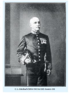
Carl Ludolf Griesbach assumed charge of the Department on 20 July 1894. He was then 47 years old and had very valuable work in Afghanistan, Persia, and Turkestan with the Boundary Commission and in the Central Himalayas to his credit. In 1902, when he attained the age of 55, the Government granted him an extension for one year, at the end of which he retired, having served for 25 years in all.
Carl Ludolf Griesbach
Carl Ludolf Griesbach (11 December 1847 – 13 April 1907) was born in Vienna on 11 December 1847, and was the eldest son of Mr George L. Griesbach, of Zobelsberg, a British subject. Carl was educated at the University of Vienna and was for some time engaged in the Geological Survey of Vienna, where he acquired his experience as a field geologist and palaeontologist. He commanded a German scientific expedition to East Africa from 1869-70, and on his return resided in London from 1871 to 1878, where he was engaged in scientific work; he was also a most accomplished artist. When resident in London he served as an officer in the Royal London Militia, and has since retired with the rank of Lieutenant-Colonel. He was decorated for the Boundary Commission; received the Afghan medal and clasp, and the Burma medal and clasp; H.I.M. the Emperor of Austria-Hungary presented him with the Austrian gold medal in connection with the scientific expedition to the central regions of the Himalayas in 1892.
In 1878 he was appointed Assistant Superintendent to the Geological Survey of India and joined in Calcutta the same year. He passed through various grades of promotion from 1880 to 1884. From 1884 to 1886 Mr Griesbach was employed on the African Boundary Commission, with the grade of Deputy Superintendent, and was raised first-grade Superintendent in November 1886. From January 1888 to July 1889, his services were placed at the disposal of H.H. the Amir of Kabul, and he was made a Superintendent in 1889, and- on the retirement of Dr William King- Director of the Geological Survey in 1894. Mr Griesbach served for twenty-five years on the Geological Survey of India. He was elected a Fellow of the Geological Society of London in 1874. He died on 13 April 1907.
During the period of his Directorship, an important addition to the cadre of the Department was made in the appointment of several mining officers, the want of which had been keenly felt by his predecessor King in explorations for coal and oil, etc. The posts of Specialist in Mining and Metallurgy and the Inspector of Mines were created to which, in 1894, William Anderson and James Grundy were appointed respectively. The posts of a specialist in coal mining and of another in gold mining were also introduced. George Frederick Reader joined the first post in November 1899, and Frederick Henry Hatch the second in March 1900.
Early in 1902, the mining side was separated from the Geological Survey of India, the mining specialists being transferred to the newly created Department of ‘The Bureau of Mines Inspection ‘under the Specialist in Mining and Metallurgy, henceforward called ‘Chief Inspector of Mines.’ In 1904 the name of this new department was changed to the ‘Department of Mines’, and its office was shifted to No9, Pretoria Street, Calcutta, and subsequently to Dhanbad.
The relevant short notes of the General Report on the work carried on by the GSI for the period from 1 April 1899 to 31 March 1900 under the direction of C. L. Griesbach, C.I.E., F.G.S. can be described as follows: -
Palaeontological work
During the progress of surveys carried on in the Shan hills, Messrs. La Touche, Middlemiss, and Dutta acquired a most interesting series of Paleozoic fossils. Most of them are either of Silurian or Devonian age. Mr Middlemiss discovered Permian fossils in the southern Shan States, but his efforts to trace the locality into the Karenni country, where Triassic fossils were supposed to have been found, failed entirely.
Dr Fritz Noetling, a palaeontologist, continued the description of the large collections from the Miocene beds of Burma. He has taken much trouble in dealing with this subject which, owing to the almost total absence of any literature of reference, was particularly intricate, and in order to arrive at a correct idea as to the true relationship of this fauna, he was obliged to compare the fossil specimens with their living relatives inhabiting the Indian Ocean. The results are very satisfactory and Dr Noetling’s memoir will remain a standard work for the study of the Tertiary fauna of India, particularly as he indicated a new direction in which research of this kind should take in the future. According to Dr Noetling, the fauna of the Miocene of Burma would therefore be composed of Paleogene species and Neogene species. This fauna lived in a very shallow sea not exceeding 25 meters in depth, and as there are several fossiliferous horizons succeeding each other in the vertical direction in a series measuring not less than 2,450 feet in thickness, the deposit of the Miocene beds must have accumulated during a time of rapid subsidence.
Messrs. La Touche and Dutta worked along the section between Mandalay and the Kunlong Ferry of the Salween, whilst Mr Middlemiss conducted a rapid traverse through the southern Shan States and the Karenni hills. The results obtained are exceedingly interesting; in the northern Shan States, some additions were made to the geological notes on the country given by Dr F. Noetling and some fossils were collected. Mr La Touche comes to the conclusion that “The formations met with along the route traversed by me, that is, the railway line under construction between Mandalay and the Kunlong Ferry, are more than eight formations from Lower Silurian to recent such as Sedaw limestone, Red Crinoid beds, Nyaungbaw beds, Naung Kangyi beds, Zeepingyi beds, Maymyo limestone, Kyinsi beds, and Namyao beds.
The most interesting of the new formations discovered are the black graptolite shales with the underlying trilobite beds of the Zeepingyi beds. The graptolite and trilobite beds are well seen in the railway cuttings on either side of Zeepingyi Railway Station. (The author’s third-year geology field area with Demonstrator Jimmy Than Tun in 1970). The shales and limestones of the Nyaungkangyi beds contain large numbers of casts of Orthis and Strophomena. These beds are well exposed in the Goktei gorge between the 84th and 86th miles on the cart -road. They also occur in the low hills about two miles north of Maymyo.
A further and most interesting fact is the proof that the Miocene of Burma does not share a single species in common with the Miocene fauna of Europe, but exhibits a great similarity with the Miocene of Java and Sumatra on one side and the fauna of the Gaj beds of western India on the other side.
Mineral Exploration
The most important areas in this respect are Burma and southern India; the work in Burma has been put in charge of Mr G. S. Stonier, whilst Mr H. H. Hayden has begun the inquiry in the Wynaad. Both have given preliminary accounts of their surveys, which will be continued during the greater part of next year (1900-1901). The well-known expert in gold mining, Dr F. H. Hatch, joined the staff of the Department on 31 March of this year and will conjointly with the officers named above, continue the study of gold in India.
Regarding the work of the mining specialists’ regions in Burma and South India were put in the charge of Stonier and Hatch respectively. The former confined his attention to the Wuntho district in Burma and the latter, along with Hayden, examined the important reefs of Kolar and Wynaad.
Investigations were practically confined to the Wuntho district only, and a preliminary report on the results of this season’s work is given in Part III. The district is evidently fairly well provided with auriferous reefs, though up to date all the leaders and reefs which have been examined were very limited in dimensions. There is no doubt of the presence of gold in paying quantities, whilst in some cases, the reefs may even be called rich, but there remains doubt whether there is sufficient ore to repay working it on a large scale, which alone would ensure commercial success. Towards the end of March, Mr Stonier came across what appears to be a promising quartz-reef near Banmauk, which runs to nine DWTs. over a width of nine inches. He is now engaged in testing the extent of the reef.
During his tour, Mr Middlemiss visited and examined some lead, silver, and copper mines near Bawzaing and Myinkyardo; some coal near Inwun, and lignite at several points in the Thamakan plateau. He also visited the “green-stone” tract on the Salween River near Namon and found the stone (which is being collected as gems) to be green tourmaline with crystalline marble as a matrix.
Dr Noetling’s memoir is not only very important from a purely scientific point of view, but it permits definite conclusions to be drawn with regard to the occurrence of petroleum and coal in Burma, which we now know to occur in the lower Miocene only. Nothing’s inquiry into the occurrence of oil in the neighbourhood of Yenangyaung in Burma was brought to a successful close towards the end of the field season 1894-95. In his report, which was comprehensive and published in the form of a Memoir, he arrived at the conclusion that the field would not last for long.
Geological Sketch of the Country north of Bhamo
C. L. Griesbach (1892) reported the Geological Sketch of the country north of Bhamo and can be extracted some significant points as follows: -
East and north-east of Bhamo a series of hill ranges, all more or less parallel to each other, forms a compact mountain system, which has been traced to the far north of the Maikha branch of the Irrawaddi by Major Hobday and others, and which in some way, not known to us exactly, is most probably linked to the north-eastern extension of the Himalayan system. It forms a natural frontier between Burma and China, but not the watershed between the former country and Yunnan, which has not been explored yet. This system of ranges rises to considerable heights (8,000 to 9,000 feet) and possesses an average direction of a strike from south to north and northeast, a direction which coincides as I have ascertained with the general direction of the strike of the strata forming these ranges.
The principal formations found in the Northern Bhamo district are Metamorphic, including, probably the Palaeozoic group, Mesozoic strata, Tertiary beds, and Igneous rocks.
Parallel with the general strike of the lines of disturbance of the older rocks appears long strips of igneous rocks, which I believe have been intruded in fissures of dislocation. They are accompanied by numerous dykes and intrusions in the neighbouring rock formations, and there is some economic interest attached to them, in as much as the mineral known in Burma as jade occurs in veins within these igneous intrusions, which, as far as I know, are all of the basic rocks. There are three principal lines of intrusion: one, running almost due north and south along the 97 30’ longitude to near the confluence: another forming the valley of the Irrawaddi, in the defile between Bhamo and Sinbo, and continuing northwards along its right banks; the third belongs to the Jade Mines district.
Economic Aspect
Having briefly sketched the geological features of the hill ranges which bound the Irrawaddi river valley northeast of Bhamo and form our frontier with China, I may at once state that they are practically barren of all useful minerals.
The only minerals remaining to be noticed are the following: -
Coal: The only traces of coal which occur within the area described here are found some 10 miles west of Mogaung, noticed by Dr Noetling; but they appear to be of little if any, value.
Gold: Gold is found in the form of fine grains and leaflets in the recent deposits of Irrawaddi valley and all its tributaries. Its presence is known to the natives, who wash these deposits after a fashion and make thereby from about 4 to 12 annas (1 anna = 116 rupees) per day a man. It seems highly probable that within the thickness of the sub-recent gravels and clays of the Upper Irrawaddi, a horizon may be found in which gold is more plentiful and which might pay if regularly mined for on a large scale. Even as it is, the surface sands along the banks contain probably not less than 30 grains per ton of dirt, which would be good enough to pay for working on a large scale. The only place where I saw natives digging deeper into the auriferous deposits was about 2 miles north of Myothit, north-east of Bhamo, where they have dug a trench several feet deep and some 40 to 50 feet long into much decomposed gneissic strata, which they wash for gold. The presence of gold in this rock must be in very finely disseminated form, and I have satisfied myself that in the last-mentioned locality there is no auriferous load or reef, but that the gold occurs in the gneiss itself in very minute quantities. I have not seen nor even heard of any locality where gold occurred in reefs. Spinal; rubies: Major Hobday of the Survey of India reported his discovery by him of numerous crystals of spinel in the recent deposits near the junction of the Pungin Kha and Mali Kha, north of the confluence. I myself have met with very minute fragments of such crystals in the sands and recent alluvium of the Irrawaddi below Myitkyina, where the heavy iron sand which is left in the cradles along with gold flakes when washing the sands for the latter, is often largely mixed with the fine splinters of spinal crystals. The deposits near the Pungin Kha contain these crystals in the same manner as the alluvial gravels near Watu, and I have no doubt that they are derived from some metamorphic rock (perhaps crystalline limestone) still further north.
From the foregoing, it appears, therefore, that there are widely extended alluvial deposits in the Upper Irrawaddi valley, which are already known to contain gold, spinal, and possibly also rubies. By far the greater part of the area which is formed by these alluvial deposits is practically a desert, as very few, if any, settlements exist there, and thus the country may be looked upon as a particularly favourable field of enterprise for mining purposes if the labour difficulties could be overcome.
Reference: Record of Geological Survey of India. 1892: Vol. XXV