By THAN HTUN (GEOSCIENCE MYANMAR)
History
Anglo-Burmese Wars, (1824–26, 1852, 1885).
The First Anglo-Burmese War arose from friction between Arakan in western Burma and British-held Chittagong to the north. In 1823 Burmese forces again crossed the frontier; and the British responded in force, with a large seaborne expedition that took Rangoon (1824) without a fight. In 1825 the British Indian forces advanced northward. In a skirmish south of Ava, the Burmese general Bandula was killed and the Treaty of Yandabo (24 February 1826) formally ended the First Anglo-Burmese War and the Burmese surrendered Assam, Arakan, and the Tenasserim coast and expanding British influence in the area.
After 25 years of peace, the British Indian government sent a naval officer, Commodore Lambert, to Rangoon to investigate British merchants’ complaints of extortion. When Lambert seized a ship that belonged to the Burmese king, another war began.
By July 1852 the British had captured the ports of Lower Burma and had begun a march on the capital. Slowly but steadily the British-Indian forces occupied the central teak forests of Burma. The new king Mindon Min (ruled 1853–78) requested the dispersal of British forces. The British were unreceptive but hesitant to advance farther northward; with both sides at an impasse, the fighting simply ceased. The British then occupied all of Lower Burma but without formal recognition of the Burmese court.
During the reign of Thibaw (1878–85), the British were willing to ignore Upper Burma and concentrate on French moves in Laos, Vietnam, and Yunnan. The ensuing Anglo-French tension was the result not so much of French design as of the Burmese initiative. A letter to the French premier from the Hlutdaw (ministerial council) suggested a bilateral treaty posed a direct threat to British teak monopolies in Lower Burma. Meanwhile, the Hlutdaw fined the Bombay Burmah Trading Corporation for underreporting its extractions of teak from Toungoo. That action provoked British forces to strike. The annexation of Upper Burma was announced on Jan. 1, 1886, ending the Konbaung dynasty and Burmese independence. (Britannica)
Geological Survey of India
The beginning of the geological investigation in India was in the early part of the nineteenth century. A few amateur geologists associated with the Survey of India and Army initiated geological studies in the country. H.W. Voysey (1818-1823) of the Great Trigonometric Survey made the first Geological Map of the Hyderabad region along with a detailed report. A committee for “The Investigation of Coal and Mineral Resources” was set up in 1837. The Secretary of the Committee John McClelland made the appointment of the first professional geologist. D. H. Williams was the first Geological Surveyor appointed by the East India Company in 1846. John McClelland for the first time used the term Geological Survey of India in his report in 1848. The Geological Survey of India (GSI) was set up in 1851 primarily to find coal deposits for the Railways. The arrival of Sir Thomas Oldham, Professor of Geology at Trinity College Dublin and the Chief of Irish Geological Survey at Calcutta on 4th March 1851, marked the beginning of the continuous period of the Geological Survey of India. Over the years, it has not only grown into a repository of geo-science information required in various fields in the country but has also attained the status of a geo-scientific organisation of international repute. The main functions of GSI relate to the creation and updating of national geoscientific information and mineral resource assessment. GSI, headquartered in Kolkata, has six Regional offices located at Lucknow, Jaipur, Nagpur, Hyderabad, Shillong, and Kolkata and State Unit offices in almost all States of the country. Presently, the Geological Survey of India is an attached office to the Ministry of Mines (GSI).
After the annexation of India and Burma (Myanmar), the British Indian government appointed mostly European geologists and mining engineers for the exploration and exploitation of mineral resources in her colonial regions.
This is my compilation of the senior GSI geologists who contributed geology of Myanmar before its independence so as to inspire young Myanmar geologists and to know how former geologists were striving for exploration in their respective fields. All the information is mainly based on the record of the Geological Survey of India. In this account, permit me to use the original names as it is instead of Myanmar names in order to get the historic sense.
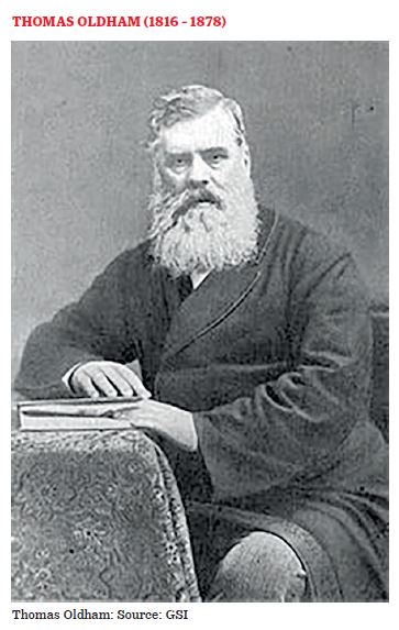
Thomas Oldham (4 May 1816, Dublin-17 July 1878, Rugby) was an Anglo-Irish geologist. He was educated at Trinity College, Dublin, and studied civil engineering at the University of Edinburgh as well as geology under Robert Jameson.
When Thomas Oldham joined the post of Geological Surveyor as successor to Williams at the age of 35, he was already a Fellow of the Royal Society of London, Professor of Geology in Dublin, and Local Director of the Geological Survey of Ireland, and President of the Geological Society, Dublin. His appointment was for five years in the first instance, the term is extended by five-yearly contracts till 1876 when he retired from India at the age of nearly 60 after serving for 25 years. Following McClelland, he assumed the designation Superintendent of the Geological Survey of India and was so addressed in official correspondence until his retirement.
Thomas Oldham had no permanent headquarters until 1855 when a house was fitted up as an office at 1 Hastings Street, Calcutta. Soon after his arrival in India, he began fieldwork in the Khasi hills and in the Damodar valley, areas that were either known or reported to be rich in mineral resources, particularly coal. Starting the work alone, Oldham gradually added to his department one or two officers a year until by 1855 he had on his staff: J. G. Medlicott, W. Theobald, H. B. Medlicott, W. T. Blanford, and H. F. Blanford. Of this initial team of geologists, Oldham and the two Medlicotts came from Trinity College, Dublin, and the two Blanfords from the Royal School of Mines, London. H. B. Medlicott and the two Blanfords were admitted as Fellows of the Royal Society, London subsequently.
Court of Ava
Accompanied by Theobald, Oldham visited the Tenasserim (Tanintharyi) province and the lower part of the Irrawaddy valley in Burma. He then accompanied Major Phayre on his celebrated visit to the court of Ava, between the second and the third Burmese wars. In the Yenangyaung oilfield which also he visited in 1855, he is said to have been the first to recognize the connection between anticlinal structures and the collection of oil.
The two Blanfords, with the aid of Theobald, surveyed the Talchir coalfield in Orissa, during the field season of 1855-56, the results being recorded in a paper “On the Geological Structure and Relations of the Talcheer Coalfield, in the District of Cuttack”. This memoir was thus the first systematic study of Indian geology to be published by the Geological Survey of India.
The two assistants, R. Trench and F. Fedden, who arrived in October 1860, represented an addition to the staff of two posts, to enable a geological survey of the British territories in Burma to be undertaken. W. T. Blanford was selected to commence this work, with one of the new Assistants, Fedden. The only district in the Pegu territory of which Revenue Survey maps were then ready was Henzada, and consequently work was begun there.
King and Foote discovered stone implements over a wide extent of the country to the west and north of Madras city. Similar finds were later made by Ball and Theobald in other parts of India and Burma. When discussing the stone implements of Burma, Theobald notes “…it would be difficult to say from shape or manufactured whether any particular implementation of palaeolithic type had been manufactured in Kent or Kuddapah, or if a particular neolithic belt of greenstone was from the neighbourhood of the Son or the banks of the Shannon”.
Due to Oldham’s earnest endeavours, an attempt was made to train Indian geologists through a system of apprenticeship, as geology was not taught in colleges in India at that time. Three students were recruited, Ram Singh in 1873 and Kishen Singh and Hira Lall in 1874. The two latter served with sufficient credit to be promoted as Sub-Assistants on the 1st of April 1879 and retired in 1903 and 1904 respectively.
Fossil-wood group
Theobald’s work in Burma from 1867 to 1872-73 laid the foundations of our knowledge of the geology of Burma from Cape Negrais up to latitude 19˚30´North. Of the terms proposed by him to designate his Burmese formations, the well-known ones are the Fossil-wood group (later changed to Irrawaddy Formation), the Pegu group, the Negrais group, and the Axial group. He also gave an account of the petroleum occurrences and of brine springs.
Mergui Series
It was T. Oldham who first gave the name of Mergui Series to an unfossiliferous formation consisting of the great group of grits, crushed shales, agglomerates, limestones, and quartzites, which occur so widely in the Tenasserim division and occur stratigraphically below his Moulmein Series, which includes limestones that are known to be Carboniferous in age (H. L. Chhibber, 1934)
Ava Earthquake of 23 March 1839.
A very serious destructive earthquake within Burmese limits occurred on 23 March 1839, the details of which were collected by Dr T. Oldham the founder of the Geological Survey of India. The shock was felt throughout the whole Burman Empire from Bhamo to Rangoon and even as far as Siam. This earthquake caused such terrible destruction so much so that the Pagoda of Mingon, doubtless one of the largest masses of solid brickwork in the world, was utterly shattered. The following are some of the extracts from Mr Spear’s account given in response to Dr Oldham’s inquiries:
“On Saturday morning, 23 March 1839, at about 4.0 a.m., Amarapoora was visited by an earthquake that surprised the oldest inhabitants with its violence. Burman’s history mentions nothing of the kind has taken place before. I did not even know it was an earthquake until it was finished. The shock may have taken up about thirty seconds. This earthquake was felt at Bhamo and. Rangoon; in fact, all over Burmese territory. In Rangoon, the time observed was very nearly the same as here; it did no damage, but was strong enough to ring Pagoda and some house bells, and alarm the inhabitants. From all that I have been able to learn, I think Ava must have been about the centre”.
T. Oldham wrote “Notes on the Geological features of the Banks of the Irawadi, and of the country north of Amarapoora.” Yule’s Mission to Ava, 1858. On the eastern flanks of the Arakan range in Manipur hills, Oldham mapped a band of serpentine stretching for a distance of nearly forty miles with a breadth of about one mile. He found dark-coloured serpentine and gabbro.
Oldham resigned from his position in India in 1876 on the grounds of poor health and retired to Rugby in England. In recognition of his lifetime’s “long & important services in the science of geology”, including Palaeontographica Indica, he was awarded the Royal Society’s, Royal Medal. He died on 17 July 1878 at the age of 62.
References:
1. Geological Survey of India
2. H. L. Chhibber. 1934. Geology of Burma
3. Wikipedia